




















Those who manage forests in Italy’s inland areas know well this issue: describing forest structure and ecological conditions requires time, specialised expertise and field surveys that are not always affordable for a small forest owner, a forest consortium or a local authority. Fieldwork provides essential detail, but extending the same observations across thousands of hectares is a very different challenge.
This is where space-based observation changes the perspective. It does not replace work in the forest, but it makes it possible to recognise patterns and contrasts over large areas and to identify where more detailed investigation is needed.
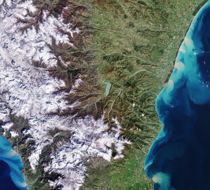
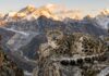
Pollino National Park from Sentinel-2. Pollino National Park as observed by the Copernicus Sentinel-2 mission. Source: Contains modified Copernicus Sentinel data (2023), processed by ESA. CC BY-SA 3.0 IGO.
Inside the canopy
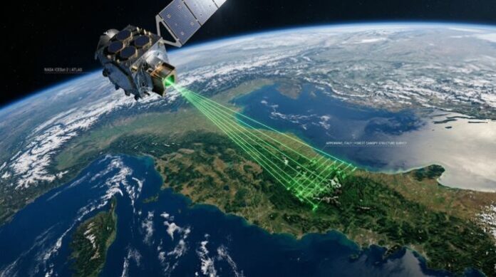
One of the most interesting instruments is GEDI, the Global Ecosystem Dynamics Investigation, a NASA lidar mounted on the International Space Station. Rather than simply imaging the Earth’s surface, it sends laser pulses towards the ground and records the signal returned by the vegetation and the ground beneath it.
Each GEDI footprint covers an area roughly 25 metres in diameter. The returned signal provides information on vegetation height and on how vegetation is distributed along the vertical profile: GEDI therefore tells us not only how tall a forest is, but also something about its internal architecture.
The laser, however, does not observe every metre of the landscape. As the Space Station moves along its orbit, GEDI collects sequences of footprints along discrete tracks, rather like an enormous comb passing over the Earth’s surface. After a pause from March 2023 to April 2024, GEDI resumed operations and continues to collect observations.
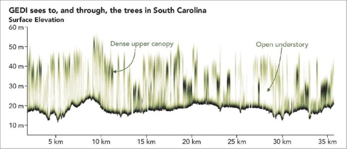
Figure 2. GEDI observation tracks. The lidar mounted on the International Space Station samples vegetation along discrete tracks, providing information on canopy height and the vertical distribution of vegetation within the areas crossed by the laser. Source: NASA Earth Observatory / GEDI.
The picture is complemented by Sentinel-1 and Sentinel-2, missions of the European Union’s Copernicus programme. Sentinel-1 uses radar and can acquire information at night and through cloud cover; Sentinel-2 observes vegetation across several regions of the electromagnetic spectrum, including wavelengths invisible to the human eye. Unlike GEDI, the Sentinel missions do not directly observe the vertical forest structure: their main advantage is systematic and repeated coverage of the territory.
From tracks to maps
Combining these instruments opens up some of the most interesting applications.
GEDI provides highly detailed but spatially discontinuous measurements. Through modelling approaches, these observations can be combined with spatially continuous satellite imagery, allowing the laser information to contribute to estimates of structural complexity in the areas between individual GEDI tracks.
In February 2026, the GEDI team took an important step in this direction by releasing a new version of the global vegetation structural complexity map. The product integrates GEDI lidar observations with satellite radar data and estimates vertical vegetation structural complexity at a spatial resolution of 25 metres. The maps provide near-global coverage of land areas and are available at three-month intervals for the period 2015-2022. Each estimate is also accompanied by information on its associated uncertainty.
This represents an important change in scale: a forest property that traditionally required field measurements or dedicated airborne lidar surveys can now be investigated, with the necessary caution, over vastly larger areas. Meanwhile, in 2025 the European Space Agency launched Biomass, the first satellite equipped with a P-band radar, which is particularly sensitive to the woody components of vegetation. Because of international frequency-sharing constraints, however, acquisitions are excluded over much of Europe and North America. This limits the direct applicability of Biomass to Italian forests, for which GEDI and Sentinel remain more readily usable.
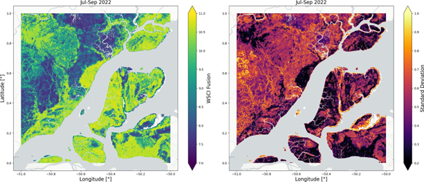
Example of the new GEDI structural complexity maps. The estimated vegetation structural complexity index is shown on the left, with the associated uncertainty on the right. The product combines spaceborne lidar and radar observations at a spatial resolution of 25 metres. Source: GEDI L4C Global WSCI Fusion Product v2, NASA ORNL DAAC.
Structure and biodiversity
Why should forest structure matter so much?
No satellite can fly over a beech forest and simply tell us how many plant, bird or insect species live within it. Biodiversity still requires field surveys when it is to be documented directly. However, part of this biological richness can be reflected in forest structure, leaving indirect signals in canopy arrangement, variation in tree height and the vertical organisation of vegetation.
A forest composed of similarly sized trees and a relatively uniform canopy is structurally very different from one containing both short and tall trees, canopy openings and several vegetation layers. Such heterogeneity can generate a wider range of sunlight, temperature and moisture conditions and, with them, a greater variety of available microhabitats.
This does not mean that a structurally complex forest is automatically richer in species. Apparently simple ecosystems may have very high conservation value. Rather, forest structure contains part of the ecological information that characterises a forest ecosystem.
In 2023, a group of researchers compared canopy-height heterogeneity derived from GEDI-based maps with tree species diversity measured in forests in the Italian Alps and Germany. Their results showed that variation in canopy height can act as an indicator of tree diversity, although the strength of the relationship depended on forest type, tree density and the spatial scale.
An even broader result emerged from a study of natural and semi-natural forests with low disturbance degree at a near-global extent. Forest structural characteristics observed by GEDI explained up to about two-thirds of the variation in tree species richness among the analysed areas. However, an important part of the same signal overlapped with environmental and biogeographical factors, including climate effects.
GEDI therefore does not directly detect species. Rather, forest architecture can retain part of the imprint of the ecological processes that have shaped it. This is also why knowing tree height alone is not enough: two forests both twenty metres tall may conceal profoundly different structures beneath an apparently similar surface.
The carbon challenge
The picture becomes more complex when forest structure is used to estimate biomass and stored carbon.
GEDI observes physical properties of vegetation. Biomass, by contrast, must be estimated using models that relate those observations to the amount of woody material present. Each additional step inevitably introduces another source of uncertainty.
Studies in Mediterranean forests showed that estimation accuracy can vary substantially among different forest types. A useful example comes from Apulia, in southern Italy. In 2025, researchers from the University of Bari and other institutions compared a standard GEDI aboveground-biomass product with regional forest inventory data. Without local adaptation, the product substantially underestimated biomass. When the researchers developed locally calibrated models from GEDI metrics, the overall error relative to the reference data fell by about two-thirds. This distinction matters: the limitation does not necessarily lie in the satellite itself, but could emerge when generalised products or models are applied without accounting for local forest conditions.
Space and field data
The same principle applies when these observations enter more operational contexts, such as the carbon market. Satellite observations are already used in some certification methodologies. In Verra’s VM0047 methodology, for example, the area-based approach uses remotely detected changes in vegetation cover together with plot-based sampling to quantify carbon removals from afforestation, reforestation and revegetation projects.
The point, therefore, is not to choose between satellite observations and field surveys. Satellites can observe large areas using consistent criteria, repeat measurements over time and identify spatial differences or changes. Field surveys, in contrast, can identify species, measure characteristics that sensors cannot observe directly and establish the ecological meaning of patterns detected in remotely sensed data. They represent two different scales of observation, and their value increases substantially when they are used together.
From data to action
For a small forest owner, a forest consortium or a local authority, the most immediate benefit of these technologies may therefore be far more practical than the sale of carbon credits.
They make it possible to examine an entire forest holding, recognise areas with different structural conditions, identify changes or anomalies and determine where field inspections and more detailed surveys should be concentrated.
A map of structural complexity cannot, on its own, determine which area has the greatest conservation value, nor can it automatically indicate where management or conservation measures should be implemented. It can, however, greatly reduce the area that needs to be explored and help formulate more precise questions before entering the forest.
Perhaps this is the most important change. Space-based observations do not allow us to understand a forest without setting foot in it. They allow us, for the first time, to know much better where to set foot and what to look for.