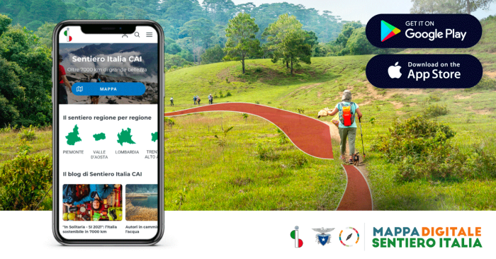
From today there is a new way to discover the Italian paths. The app “Digital Map of the CAI Italy Path” (mappadigitalesentieroitalia.it), created by Webmapp in collaboration with the Italian Alpine Club, offers itineraries specially designed for hiking that describe the physical and natural characteristics of the area in high fidelity.
‘With the Sentiero Italia project,’ says Antonio Montani, General President of the CAI, ‘thanks to the extraordinary commitment of the numerous volunteers of the Italian Alpine Club who have worked along the peninsula, we have succeeded in uniting our wonderful country with this great path. The Sentiero Italia remains a project of primary importance because hiking tourism allows people to discover the beautiful territories that Italy has to offer, favouring a sustainable and responsible development of inland and mountain areas. A strategic objective, shared and supported by the Ministry of Tourism’.
There are many advantages of the maps, created with a dedicated cartographic style: the safety of an excursion with the official routes of the Sentiero Italia CAI, the simplicity of travelling and being guided by an app designed by hikers for hikers, and the practicality of having georeferenced maps in image format, compatible with navigation apps.
The features of the new application
With the new application it is possible to subdivide the more than 500 stages of the SICAI by region and, for a quick search, it is possible to use the stage abbreviation, the starting point and the arrival point as a filter, up to displaying all the stages of the national territory for a total of 7,000 kilometres of routes and paths. Particularly useful in the field is the geolocalisation function that, if activated, shows the position of the device used in the map interface.
In addition, it is possible to view technical details with description and photos for each individual stage, download the map data offline, navigate along the stage route and share it on social networks.
Orographic gradient, contour lines and anthropic elements
Digital maps describe the physical and natural characteristics of the territory with particular fidelity. This is possible through the reworking of open cartographic data produced by public administrations. The high-resolution digital terrain model and land-use data make it possible to create the orographic outline (the shadows of the slopes) and contour lines in great detail. The hiker will thus be able to read the morphology of the terrain at a glance in order to better orient himself.
Above the ‘natural’ layer, the map shows the anthropic elements, consisting of buildings and the transport network, as well as a rich toponymy. The transport network includes major roads down to minor footpaths. This geographical information is retrieved and continuously updated from the OpenStreetMap database.
“This specific app is an innovative digital tool to raise awareness of the CAI Sentiero Italia – says Paolo Valoti, Presidential Delegate for the CAI Italian Path, the Paths and Cartography Operational Structure (Sosec) and the refuges – and to offer all Italian and foreign enthusiasts the information, data and cartography to walk one of the longest paths in the world, among the beauty, people, history, landscapes and biodiversity of the territory, from the Apennines to the Alps. The CAI, through its Paths and Cartography Operational Structure and the territorial technical bodies, is also completing the stacking of the paths of the Italian Hiking Network and the creation of the National Cadastre of Paths, which will be made available on a computer platform for all hikers and walkers“.

Free download until the end of September
Throughout the month of September, a promotion will be running that will allow members and non-members of Cai to download the application’s contents free of charge.
With the new SICAI app, it is therefore possible to carry the map of one of the longest hiking routes in the world with you at all times. A route that starts in Santa Teresa Gallura, Sardinia, and ends in Muggia, in the province of Trieste, after having climbed the Apennine ridge and the Alpine arc, touching on all Italian regions. For the most part, the itinerary uses some of the great pre-existing trail routes: the Grande Traversata delle Alpi in Piedmont, which is about 1,000 kilometres long; the Alta Via dei Monti Liguri in Liguria (44 stages for more than 400 kilometres); the 28 stages of the Grande Escursione Appenninica in Tuscany and Emilia-Romagna (425 kilometres); and the Sentiero del Brigante in Calabria, with its nine stages (120 kilometres long).


