


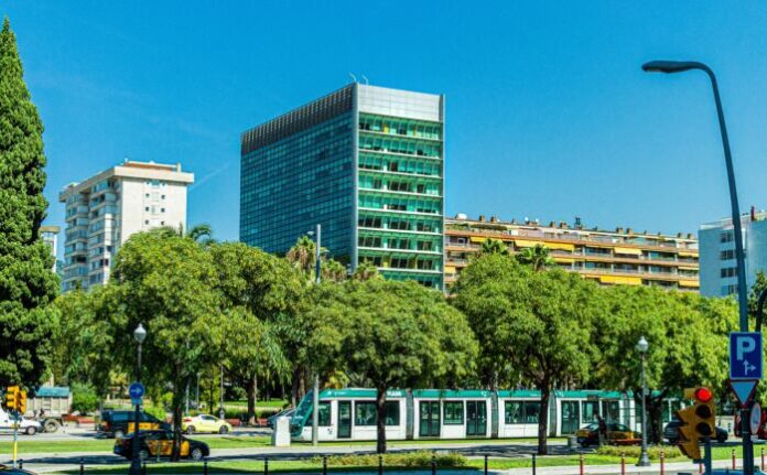
Over half of the world’s population now lives in cities, and it is for this reason that more and more attention is being paid to studies that investigate the livability of urban environments. In Italy there are 42 million people living in the city, about 70%. The urban ecosystem is characterized by two fundamental elements: the vegetated surfaces and the impermeable ones (soil consumption).
The right compromise between the quantity of these two elements influences the composition of the urban landscape, also modifying the microclimate and favoring a typically urban phenomenon known as an “urban heat island”. With this definition we mean the central areas of cities that are significantly warmer than neighboring or rural areas.
Researchers from the Institute for Bioeconomy of the National Research Council of Florence (Cnr-Ibe), in collaboration with researchers from the Higher Institute for Environmental Protection and Research (Ispra), conducted a study on the influence of coverage arboreal and land take on urban surface temperatures, recently published in Science of the Total Environment.
“The study was conducted on the summer daytime period, analyzing for the first time the influence of tree cover and land consumption in favoring the surface urban heat island in the 10 metropolitan cities of peninsular Italy”, explains Marco Morabito of Cnr-Ibe and coordinator of the work.
The research took into consideration the city made up of its metropolitan nucleus, represented by the main municipality, by the neighboring and peripheral municipalities; the altitude, the distance from the sea and the size of the city were also examined. “Surface temperature satellite data were used, referring to the summer day period from 2016 to 2018, while using the high resolution data developed by Ispra it was possible to understand the influence of land consumption and tree cover”, adds Michele Munafò of Ispra.
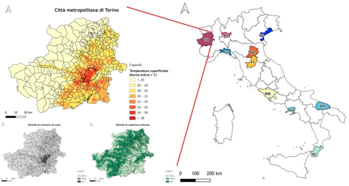
From the integration of this information, the researchers have thus produced a new information tool called “Urban Surface Landscape layer”, that is an indicator of the surface coverage of the urban landscape capable of representing areas of cities characterized by different combinations of land use density. and tree cover, and capable of identifying critical urban areas, with high surface temperatures, which require mitigation actions and in particular an intensification of tree cover.
“The study shows that the intensity of the surface urban heat island increases especially as the extension of the areas with low density of tree cover in the metropolitan core increases, or by intensifying the artificial cover due to buildings and infrastructures”, concludes Morabito.
“The most intense heat islands were observed in inland and larger cities: in Turin, a 10% increase in the central core of areas with high land use and low tree cover is associated with an increase in intensity the average summer heat island of 4 ° C. In general, the larger and more compact the cities, the greater the intensity of the heat island phenomenon. The latter, on the other hand, was often less intense and not very evident in coastal cities mainly due to the mitigating effect of the sea”.


