


Thousands of hectares of forest are burning in the Mediterranean Basin. In Italy and more in general in Europe, several wildfires lead to the destruction and decline of important forest heritages that host a wide variety of vegetal species, each with specific ecological requirements. Fire intensity and frequency have increased in the last few years, due to anthropogenic land consumption, leading to the depletion of natural communities. Evidences showed clearly the increase of arsons as the main cause of wildfires, in order to expand or renew the pasture at the expense of the forest, eliminate agricultural-forest residues and remove vegetation from uncultivated land.
According to the Report on the state of Italian forests “2017-2018”, 2017 recorded the largest burned surface area (160.000 ha) since 1980, where 70% was represented by forests. The year 2020 is no an exception: in the post-lockdown period up to today, several wildfires occurred, especially affecting protected areas (National Parks and Natural Reserves), causing damage on biodiversity conservation. A high inter-annual variability of wildfires was observed in the Mediterranean Region, mainly due to both anthropogenic land use changes and climate change impacts.
The climate forcing, represented by the increase of extreme weather events such as heatwaves recorded in the last 30 years, have lead on the one hand to an increase in evapotranspiration and on the other to an extension of the high fire risk period. As specified in the Greenpeace-Sisef report “Un Paese che brucia”, winds and droughts play a key role in the fire spreading, for example typical hot and dry winds of Mediterranean summer such as Sirocco and Mistral, or prolonged heatwaves reduce vegetation moisture and consequently increase fire risk. Finally the large burned forest area contribute to increase greenhouse gases emissions affecting air quality and forcing climate change.
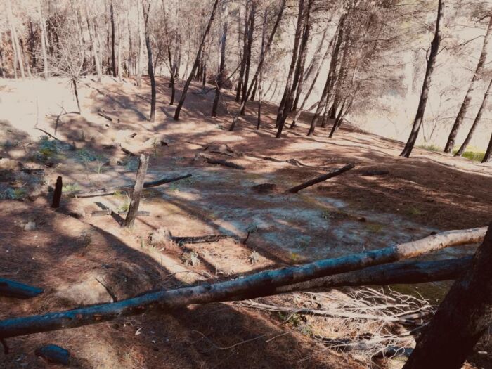
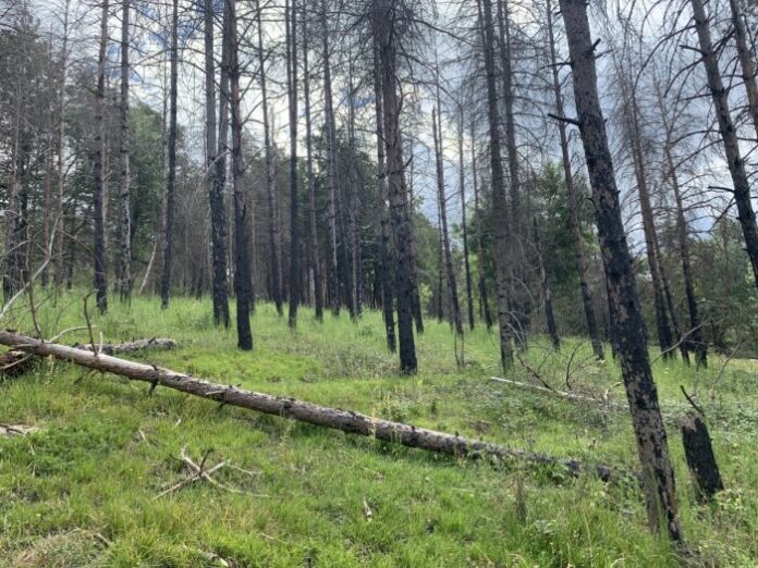
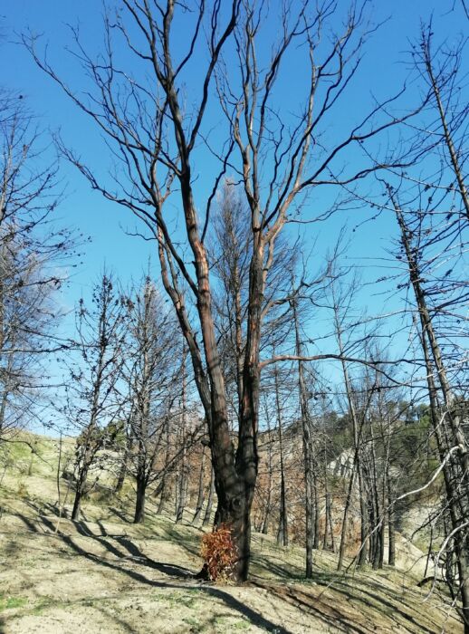
Forest ecosystems show several fire disturbance feedbacks, depending on type of vegetational biomass and environmental condition such as fuel moisture content. Several type of forest vegetation are more affected than other: Mediterranean coniferous stand are generally characterized by high flammability, promoting fire spread and feeding large wildfires. An interesting example is a pine forest wildfire (c.a. 200 ha) occurred in July 2020 within the Special Protection Area “Gran Sasso National Park-Monti della Laga”, affecting the Community Interest habitat 4030-Lande secche europee, including an endemic species Genista pulchella Vis. Supsp. aquilana F.Conti&Manzi. Instead, the fire-resistant vegetation such as oak forests characterized by thick bark and resprouting capacity from stumps, are affected by small wildfires that can turn into large fires characterized by high severity when prolonged droughts condition persist.
Wildfires effects on forest ecosystem depends on fire severity levels: from low severity with bark slight blackened, moderate severity with bark and canopy black-brown to high severity with tree completely destroyed.
© Angelo Nolè 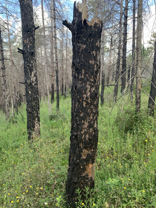
© Maria Floriana Spatola
Low severity wildfires allow the post-fire vegetation recovery, without any necessary guided interventions, while forest ecosystems affected by high severity cannot be effectively restored by natural regeneration and the post-fire vegetal succession would lead to the creation of simplified natural communities. According to the wide range of feedbacks between fire severity and forest types, scientific community is focusing on wildfires phenomenon and post-fire vegetation recovery based on fire severity levels.
Satellite imagery suitable to identify fires in real-time and evaluate wildfires effects, have been used by numerous studies. Free available satellite data (Landsat and Sentinel) and tools to analyse and process data such as Google Earth Engine platform, provide a rapid response on the state of vegetation communities, by calculation of spectral indices from pre- and post-fire imagery. However, satellite data need to be validated and calibrated against ground-truth data. Few site-specific studies about fire severity estimation from satellite data, are currently carried out in Italy. For this reason, several research projects about wildfire risk, are in progress.
The SISEF (Società Italiana di Selvicoltura ed Ecologia Forestale) Workgroup of Forest Fires Management aims to study wildfire’s disturbance prevention and environmental restoration management in burned areas. In this context, it is very important the promotion of information exchange between research and land governance for post-fire recovery management strategies.


