


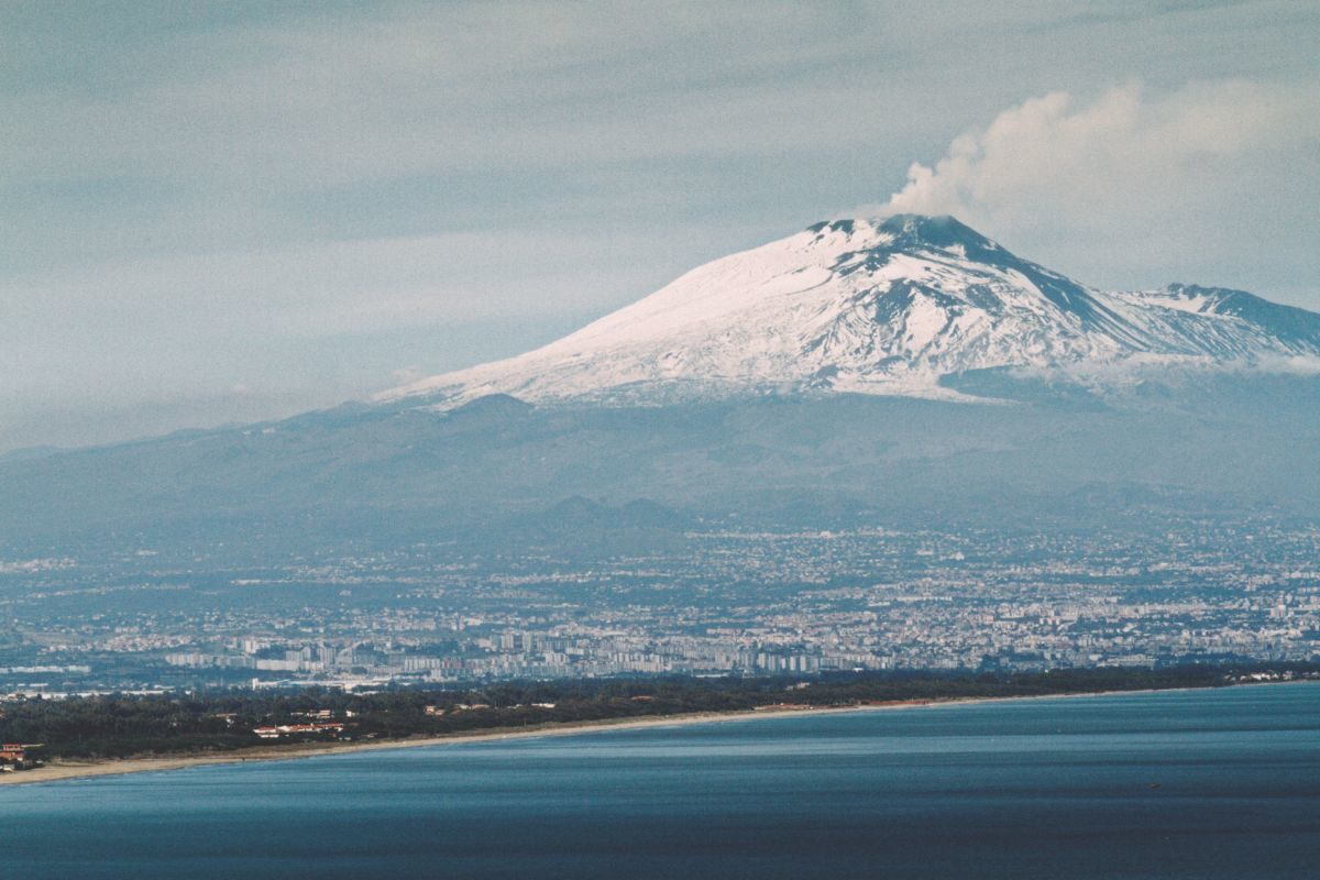
The Mt. Etna is the biggest European volcano and one of the most active volcanos of the world; localized in eastern Sicily, it elevates until 3320 m a.s.l. (in 2019) but its altitude and morphology of the top of the volcano is continuously changing because the succession of the eruptions. The volcano covers an area of 1200 km2 and it’s characterized by a pseudo-oval basal shape, bordered to west by The Simeto river, to east by the Alcantara river and the Ionian Sea costline, to south by the Catania Plain (separating the Etna from the Ibleian Mts., of volcanic origin but older – ca. 10 My) and to north by the Peloritani Mts., mainly granitic.
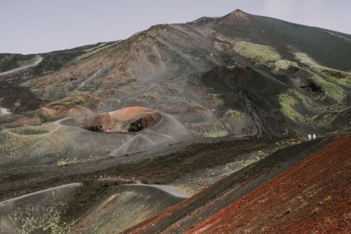
The volcano’s flanks are disseminated by lots of volcanic cones, made by lateral eruptions, most of which have big dimensions as for Mt. Minardo, Mt. Ilice, Mts. Rossi and Mts. Silvestri, while the others are significantly smaller. Around the 1800 m a.s.l. the volcano’s flanks became steeper in correspondence of the Mongibello Cone.
The volcano’s flanks are disseminated by lots of volcanic cones, made by lateral eruptions, most of which have big dimensions as for Mt. Minardo, Mt. Ilice, Mts. Rossi and Mts. Silvestri, while the others are significantly smaller. Around the 1800 m a.s.l. the volcano’s flanks became steeper in correspondence of the Mongibello Cone. The summit portion is constituted by 4 craters named Bocca Nuova, Voragine, North-East Crater and South-East Crater, at least one of which is continuously active, with lava emissions or releasing of ash and gases.
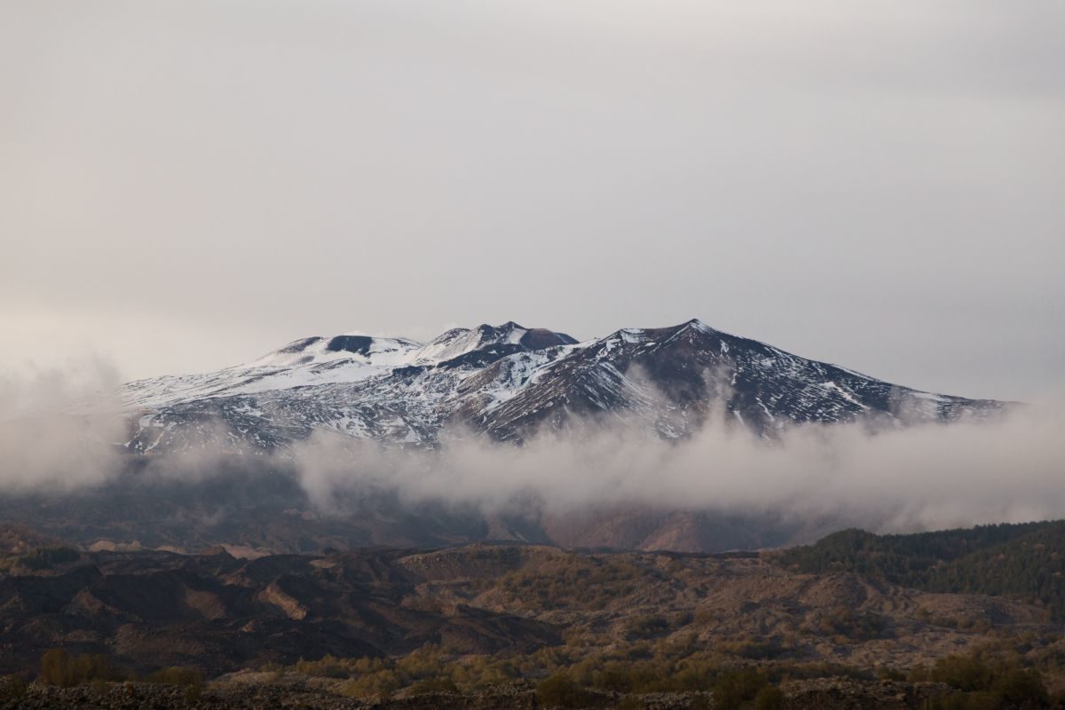
When magma is deeper and there are no eruptions, the summit craters are interested by frequent landslides. From the geodynamic point of view, the Mt. Etna is located in the zone of continental collision between Euro-Asiatic plate to north and the African plate to south, and the volcanism is favoured by the extensional tectonic of the eastern margin of Sicily, permitting the rise of magma from the earth mantle.
Mt. Etna is defined a basaltic stratovolcano characterised by very frequent eruptions both from summit craters and from lateral craters, as demonstrated by the numerous cones around the main volcanic structure. The very complex eruptive story of the Etna region was object of lots of researches and the most recent studies determine more detailed stratigraphic and geochronological results, synthesised in the geological map of Mt. Etna (1:50000).
The authors have recognised 4 phases in the eruptive story, started in the Middle Pleistocene (ca. 500 ky), when in the area was a marine gulf, in which started the first submarine manifestations (as the pillow lavas outcropping at Rupe of Aci Castello, the sub-volcanic body of the Lachea island and the stacks of Aci Trezza). The tectnonic uplift and the continuous eruptions determined the missing of the marine gulf starting the subaerial volcanic activity, migrated in time to north and north-west, until the building of the actual volcanic structure.
During the first (subaerial conditions) and the second phases, the volcanic activity was characterised mainly by fissural eruptions, with big volume of lavas emitted along the fault systems of the Simeto river valley (Adrano Paternò area) and along the Ionian Sea coastline. These eruptions are dated until 110 ky above. In the third phase was recorded an important changing in the eruptive style, passing from fissural to central activity, characterised both effusive and explosive eruptions, building the first eruptive centres of the Valle del Bove.

Numerous volcanoes subsequently formed in this period and the most important of these, named Trifoglietto volcano reached an altitude of 2400 m a.s.l., finishing its activity ca. 99 ky above. Then, others minor volcanic centres formed and the third phase terminated ca. 65 ky above, with a long period of volcanic stasis, after which started the fourth phase, named of the Stratovolcano (ca. 57 ky above). In this period there was the further migration to north-west, which determined the building of the biggest eruptive centre of the Mt. Etna structure, the so named Ellittico volcano.
It was characterised by both effusive and explosive eruptions, constituting the polygenic strato-cone that reached 3600 m of altitude. In addition it verified also lateral eruptions, determining the areal expansion of the volcano building, with the emissions of lava flows and pyroclastic deposits that radically modified the geomorphology and the hydrographyc network of the area (as the filling of paleo-valley of the Alcantara river or the lava barriers of the Simeto river valley).
The Ellittico volcano ended its activity at 15 ky above, with a series of plinian eruptions that formed a caldera and determined the dispersion of pyroclastic deposits, largely located around the flanks of the volcanic structure. During the last 15 ky, the large effusive activity fully filled the ancient caldera of the Ellittico structure, forming a new summit crater, the continuous eruptions (mainly effusive) of which caused the building of the actual volcanic top structures, named Mongibello volcano.
Around 10 ky above, its eastern flank was interested by large landslides, which formed the actual Valle del Bove. These structural collapses highlighted the inner portion of the volcanic centres both of the second phase and of the Ellittico volcano and the debris flows reached the Milo area and the Ionian coastline as the alluvional conoid of Chiancone.
The eruptive activity prosecuted mainly with effusive style, with short period of volcanic stasis, even though in historical times it was verified some large explosive eruptions (as for the 122 B.C. when there was huge damages for the ancient Catania town, excused from the payment of taxes for the following 10 years by the Roman Senate).

From Romans onwards, there was the increasing of urbanization of the Etna area and during this period, numerous lateral eruptions verified, which destroyed whole villages and various portion of the ancient Catania town (as during the Middle Ages), highlighting the high volcanic risk related to buildings and towns.
The lateral eruptions at low altitude may last from few hours to over a year (ex. 1991-1993, 472 days; 2008-2009, 419 days) and may determine huge inconveniences for populous areas and a serious danger for terrestrial and aerial traffic. For these reasons the Etna Mt. is one of the most studied volcano of the world and it is continuously monitored by the INGV of Catania, that emitted weekly and daily bulletins on the basis of the activity states. During the first days of April 2020, it occurred an explosive eruption at summit craters, characterised by strong degassement, lava fountains and the emission of an ash plume, with no particular inconveniences, but that always arouse attention for volcanologists and Civil Protection, because actually in the Etna area live ca. 700000 people. This highlights that living with geological risks must induce to never let down the guard.


